
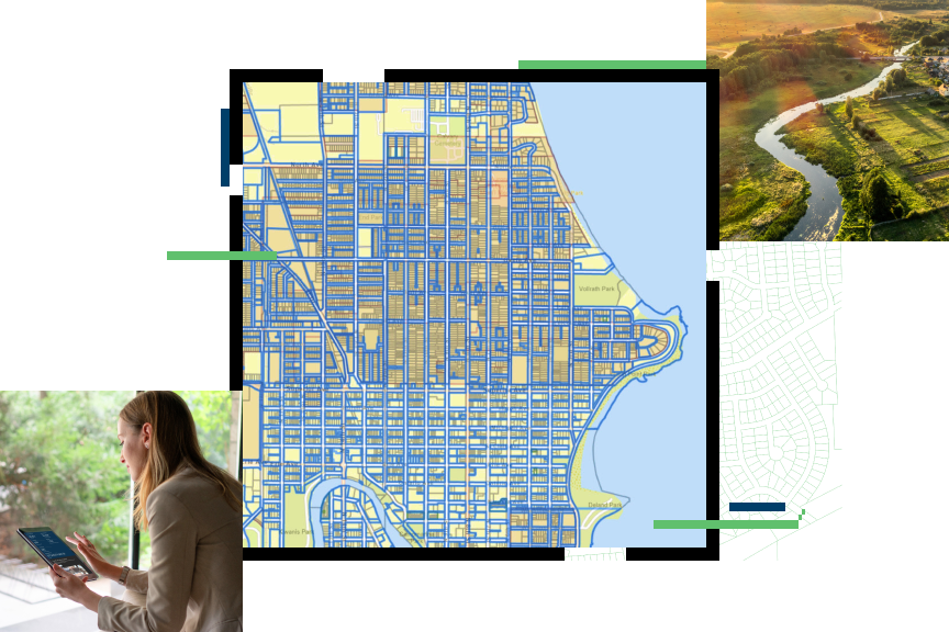
Geographic Information Systems (GIS) play a key role in modern land measurement. They offer precise, efficient, and accurate data collection and analysis.
Understanding land boundaries and features has never been more crucial. With urban development and environmental concerns on the rise, GIS technology provides the tools needed to map and measure land with accuracy. By integrating various data types, GIS helps surveyors, engineers, and planners make informed decisions.
This technology not only saves time but also reduces costs. Whether you are involved in real estate, agriculture, or urban planning, knowing how GIS impacts land measurement can be highly beneficial. Let’s explore how GIS transforms the way we measure and manage land today.
Introduction To Gis In Land Measurement
Geographic Information Systems (GIS) have transformed the way we measure and manage land. By leveraging advanced technology, GIS provides detailed, accurate, and easy-to-understand data. This helps in various fields such as urban planning, agriculture, and environmental protection. Let’s dive deeper into GIS and its importance in modern land measurement.
What Is Gis?
GIS stands for Geographic Information Systems. It is a system designed to capture, store, manipulate, analyze, manage, and present spatial or geographic data. This technology combines hardware and software to display data related to positions on Earth’s surface. With GIS, users can visualize and interpret data in various ways.
Importance In Modern Land Measurement
GIS plays a crucial role in modern land measurement. It provides precise and accurate data, which is essential for planning and development. Traditional methods are often time-consuming and prone to errors. GIS simplifies the process by offering detailed maps and models. This helps in making informed decisions.
Moreover, GIS allows for real-time data collection and analysis. This means that changes in land use can be tracked quickly. This is particularly useful for monitoring environmental changes and urban development. It also helps in disaster management by predicting and assessing the impact of natural events.
In agriculture, GIS helps in assessing soil conditions, crop health, and irrigation needs. This leads to better yield and efficient resource management. For property management, GIS provides detailed property maps and ownership information. This ensures clear and undisputed boundaries, reducing conflicts and legal issues.

Credit: cook-surveying.com
Precision In Land Measurement
Hey friends, today I want to talk about something really cool: precision in land measurement using GIS. Now, you might wonder, why is precision so important? Well, accurate land measurement helps with everything from property boundaries to construction planning. So, let’s dive into how GIS helps us get those precise measurements.
Enhanced Accuracy
First things first, let’s talk about enhanced accuracy. GIS technology uses satellites and advanced tools to measure land down to the smallest detail. Imagine using a ruler to measure a football field. Not very practical, right? But with GIS, it’s like having a super-smart ruler that never makes mistakes.
Here are some ways GIS enhances accuracy:
- High-Resolution Imagery: GIS uses high-res satellite images to capture every inch of land.
- Real-Time Data: It updates land measurements in real-time, so you always have the latest info.
- 3D Mapping: GIS can create 3D maps that show the land’s shape and size accurately.
Reducing Human Error
Now, let’s move on to reducing human error. We all make mistakes, right? But in land measurement, even a tiny mistake can cause big problems. GIS helps reduce these errors. How? By using automated systems that do the hard work for us.
Here’s a quick story: A friend of mine was measuring his property lines the old-fashioned way. He ended up measuring wrong, and it caused a dispute with his neighbor. If he had used GIS, this could have been avoided. Why? Because GIS tools are super reliable.
Some benefits of reducing human error with GIS include:
- Consistency: Measurements are consistent every time, no matter who does it.
- Speed: Automated tools are faster than manual methods.
- Documentation: Every measurement is recorded and can be easily accessed.
So, there you have it. GIS not only makes land measurement more accurate but also reduces the chance of human error. It’s like having a trusty sidekick that never lets you down. Next time you think about land measurement, remember the power of GIS. Until next time!
Efficiency Of Gis Technology
GIS technology enhances modern land measurement by providing precise and accurate data. It simplifies mapping and analysis tasks, saving time and resources. This technology is indispensable for surveyors and planners in managing land use efficiently.
Hey friends! Today, we are diving into the world of GIS technology and how it makes modern land measurement super efficient. Imagine you are trying to measure a huge piece of land. Doing this by hand would take forever, right? Well, GIS makes it so much easier and faster. Let’s look at how!Time-saving Benefits
GIS technology saves a lot of time. You don’t have to walk around with a tape measure. Instead, you can use satellite images and computer software to get accurate measurements. It’s like magic. Here’s why it’s great:- Quick Data Collection: GIS uses satellites and drones to gather data quickly.
- Automated Calculations: The software does all the math for you.
- Easy Updates: Updating measurements is fast and simple.
Cost-effectiveness
GIS technology is not only fast but also saves money. Think about it. Hiring people to measure land can be expensive. But with GIS, you can cut costs. Here’s how:- Less Manpower Needed: Fewer people are required to do the job.
- Reduced Errors: Fewer mistakes mean less money spent fixing them.
- Lower Equipment Costs: No need for expensive traditional measuring tools.
Easy Data Management
Managing data with GIS is a breeze. You can store, analyze, and retrieve data easily. This makes it simple to keep track of land measurements over time. Here are some perks:- Organized Data Storage: Keep all your data in one place.
- Simple Analysis: Analyze data with just a few clicks.
- Quick Retrieval: Find the data you need instantly.
Applications In Urban Planning
Hey friends, today let’s talk about something really cool – how GIS (Geographic Information Systems) helps in urban planning. Think of GIS as a smart map. It’s not just about roads and rivers. It’s about using data to plan cities better. Now, let’s dive into some interesting applications.
Infrastructure Development
Imagine building a new bridge or a school. Sounds easy? Not really. You need to know where to put it. That’s where GIS comes in. It helps planners see the big picture. With GIS, they can:
- Analyze traffic patterns
- Identify the best locations
- Plan utilities like water and electricity
For example, a city wants to build a new park. Using GIS, they can see which areas lack green space. They can also see where people live and work. This helps them pick the best spot for the park. Pretty smart, right?
Zoning And Land Use
Ever wondered why some areas have tall buildings and others have houses? That’s zoning. It’s like organizing your room. You need to decide where things go. GIS helps with this too.
With GIS, planners can:
- See current land use
- Predict future needs
- Plan for growth
Let’s say a city is growing fast. They need more homes. But where to build? GIS can show which areas have space. It can also show which areas are best for homes, shops, or offices. This makes zoning easier and smarter.
Here’s a fun fact. I once asked a friend who works in urban planning about their biggest challenge. They said, “It’s knowing where to build and where not to.” GIS solves this problem. It’s like having a crystal ball. It shows what the city will need in the future.
In conclusion, GIS is a powerful tool in urban planning. It helps make cities better, smarter, and more organized. Whether it’s building a new school or planning where new homes should go, GIS makes it easier. So next time you see a new park or building, think about the smart map behind it. That’s GIS at work.
Environmental Management
Hey friends, today let’s dive into how GIS (Geographic Information System) helps with environmental management. It’s a big deal when it comes to protecting our planet. GIS is like a digital map that helps us understand the world better. It’s used to track changes in the environment, manage resources, and support conservation efforts.
Conservation Efforts
Conservation is about protecting our natural world. GIS plays a huge role here. It helps to:
- Identify endangered species’ habitats
- Track illegal logging activities
- Monitor deforestation rates
For instance, I recently read about a project where GIS was used to track the migration paths of elephants. This information helps create safe corridors for them, reducing human-wildlife conflict. Pretty cool, right?
Resource Management
Managing resources well is crucial. GIS helps us do this effectively. It can:
- Map water resources
- Track soil quality
- Monitor crop health
Imagine you are a farmer. GIS can show you which parts of your field need more water or fertilizer. It’s like having a super detailed guide to make better decisions.
In a nutshell, GIS is a powerful tool for environmental management. It helps us protect nature and use resources wisely. And the best part? You don’t need to be a tech expert to understand its benefits. Just think of it as a high-tech map that guides us toward a healthier planet.
Credit: www.esri.com
Agricultural Advancements
Agriculture benefits greatly from modern technology. Geographic Information Systems (GIS) play a key role in this progress. By using GIS, farmers can gain insights that help boost productivity. This technology helps with crop management and land evaluation. In the following sections, we explore how GIS aids in agricultural advancements.
Crop Monitoring
GIS technology allows farmers to monitor crops with precision. They can track growth patterns and health. This helps identify areas needing attention. Early detection of issues like pests or diseases becomes possible. Farmers can act quickly, preventing loss and ensuring better yields. GIS also aids in planning the best times for planting and harvesting. This ensures crops are grown under optimal conditions.
Land Suitability Analysis
Land suitability analysis is another area where GIS proves useful. It helps farmers determine the best land for different crops. By analyzing soil quality, moisture levels, and other factors, GIS provides valuable data. Farmers can then make informed decisions about land use. This ensures that each plot is used to its fullest potential. It also helps reduce waste and increase overall farm productivity.
Challenges And Limitations
Hey friends, today let’s talk about some of the challenges and limitations of using GIS in modern land measurement. Like everything else, GIS has its own set of hurdles. Understanding these can help us make better use of this technology.
Technical Barriers
First up, the technical barriers. GIS is not always easy to use. It requires special software and hardware. These tools can be expensive. Plus, using GIS needs specific skills. Not everyone has these skills. Think about it like this: you wouldn’t expect everyone to know how to fly a plane, right? The same goes for GIS. It requires training and practice.
Here’s a quick look at some common technical barriers:
- High Costs: Software and hardware can be pricey.
- Specialized Skills: Users need training and experience.
- Data Compatibility: Different systems may not easily share data.
Imagine you have a super cool car, but you don’t know how to drive. It’s kind of like that with GIS. You need to know how to use it to get the most out of it.
Data Privacy Concerns
Next, let’s talk about data privacy. GIS collects a lot of data. Some of this data can be sensitive. For example, it might include personal information. This raises privacy concerns. Who can access this data? How is it stored? These are important questions.
Think about it this way: would you want everyone to know where you live? Probably not. That’s why data privacy is so important. Here are some common concerns:
- Unauthorized Access: Who gets to see the data?
- Data Security: How is the data protected?
- User Consent: Do people know their data is being used?
For instance, I recently asked a friend who works in GIS about this. He told me that they always make sure to follow strict guidelines to protect data. But even then, it’s a challenge. So, always be aware of data privacy issues when using GIS.
In summary, while GIS is a powerful tool for land measurement, it’s not without its challenges. Technical barriers and data privacy concerns are just a couple of the issues users face. By understanding these limitations, we can work towards better solutions and make the best use of GIS technology.
Future Of Gis In Land Measurement
Hey friends, today we are diving into the future of GIS in land measurement. Geographic Information Systems (GIS) have already changed how we measure and manage land. But what does the future hold? Let’s explore the potential technological innovations and developments that could shape the future of GIS in land measurement.
Technological Innovations
In the world of GIS, technology is always evolving. New tools and methods are being developed to make land measurement easier and more accurate. Here are some exciting innovations we can expect:
- Drones: Drones can capture high-resolution images from the sky. This helps survey large areas quickly.
- AI and Machine Learning: These technologies can analyze data faster than humans. They can find patterns and make predictions.
- 3D Mapping: Creating three-dimensional maps gives a better understanding of the land. It’s like looking at a miniature model of the area.
These innovations are making GIS more powerful. They help us understand the land better and make smarter decisions.
Potential Developments
What about the future? What developments might we see in GIS for land measurement? Here are some potential advancements:
- Real-Time Data: Imagine getting instant updates on land changes. Real-time data can help manage land more efficiently.
- Better Collaboration: Enhanced GIS tools will allow different teams to work together more easily. Sharing data and insights can lead to better outcomes.
- Integration with Other Technologies: GIS can be integrated with other technologies like the Internet of Things (IoT). This can provide more detailed and accurate information.
These potential developments show that GIS in land measurement has a bright future. It’s exciting to think about how these advancements can improve our understanding and management of land.
So, what’s the takeaway? The future of GIS in land measurement is full of possibilities. With new technologies and developments, we can expect GIS to become even more useful and efficient. Stay tuned to see how these changes unfold!

Credit: www.researchgate.net
Frequently Asked Questions
How Is Gis Used In Land Surveying?
GIS enhances land surveying by providing precise mapping and spatial data. Surveyors use GIS to analyze terrain, plot property boundaries, and manage land records. This technology improves accuracy and efficiency in surveying tasks.
What Is The Role Of Gis In Modern Map Making?
GIS enables accurate map making by integrating geographic data and technology. It helps visualize, analyze, and interpret spatial information effectively.
What Are The Benefits Of Using A Geographic Information System For Land Use Planning?
A geographic information system (GIS) enhances land use planning by offering accurate mapping, data analysis, and improved decision-making. It helps in resource management, environmental protection, and urban development. GIS also facilitates better communication and collaboration among stakeholders.
What Is The Main Role Of Gis?
The main role of GIS is to capture, store, analyze, and display geographic data to solve spatial problems.
Conclusion
GIS plays a key role in modern land measurement. It provides accurate data quickly. This technology enhances efficiency in various fields. Surveyors and planners benefit greatly. Using GIS saves time and resources. It ensures precise and reliable results. As technology evolves, GIS becomes even more essential.
Embrace GIS for better land management. Its impact is undeniable. The future of land measurement looks promising with GIS.

Rakib Sarwar is a seasoned professional blogger, writer, and digital marketer with over 12 years of experience in freelance writing and niche website development on Upwork. In addition to his expertise in content creation and online marketing, Rakib is a registered pharmacist. Currently, he works in the IT Division of Sonali Bank PLC, where he combines his diverse skill set to excel in his career.